MAP-BORealis - Assisted navigation in sea ice on Arctic passages by calculating optimal routes using satellite based remote sensing data
| Working Group: | WG Optimization and Optimal Control |
| Leadership: | Prof. Dr. Christof Büskens ((0421) 218-63861, E-Mail: bueskens@math.uni-bremen.de ) |
| Processor: |
Dr. Christine Eis ((0421) 218-63682, E-Mail: c.eis@uni-bremen.de)
Dmitrii Murashkin David Möhl |
| Funding: | Bundesministerium für Wirtschaft und Energie |
| Project partner: |
Drift + Noise Polar Services DLR Forschungsstelle Maritime Sicherheit, Bremen, Deutsches Zentrum für Luft- und Raumfahrt (DLR) |
| Time period: | 01.07.2019 - 30.06.2021 |

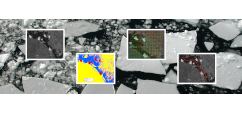
MAP-BORealis is concerned with the development of a route optimisation for vessels in ice-covered waters of the Arctic. For this purpose, innovative methods from areas such as remote sensing, machine learning, sea ice modelling and optimisation will be used and analysed with regard to their usability in this context. The aim of the project is a workflow combining sea ice classification, sea ice prediction and route optimization. The project works in cooperation with test users from different fields of application, such as the German research icebreaker FS Polarstern and the nautical crew on board Hapag Lloyd cruise ships.


